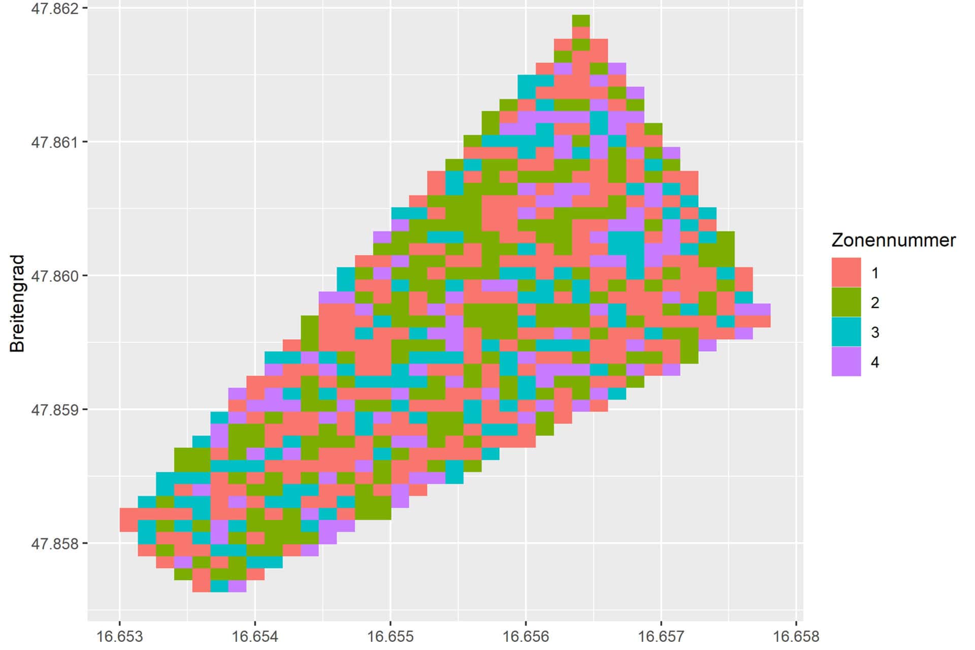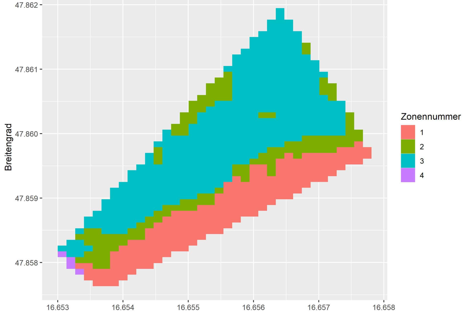
The research focuses on the detailed analysis of agricultural areas, made possible by satellite data (Sentinel 2) with a resolution of 10 x 10 metres. ‘By using multi-year data sets and taking specific growth periods into account, we are able to achieve unrivalled precision in the creation of management zone maps,’ explains Hermann Katz. Using a specially developed algorithm, soil parameters such as nutrient content and water availability are precisely recorded and visualised as homogeneous zones. This data enables farmers to manage their fields in a targeted and efficient manner.
Solutions for edge zones and soil samples
Another technological milestone of the POLICIES Institute is the elimination of boundary zone effects that occur when analysing remote sensing data. Faulty tiles, which often cover 10 x 10 metres, are smoothed by a special algorithm, allowing the fields to be used effectively right up to the edge. This is a considerable advantage, especially in the small-scale Styrian agricultural sector. The tool also makes it possible to determine representative points for soil samples, which additionally supports resource-saving cultivation.
Focus on digitalisation
The new AI tool is seamlessly integrated into the MR AgrarPortal, which was developed by JOANNEUM RESEARCH in collaboration with the province of Styria. ‘The MR AgrarPortal serves as a digital field catalogue and enables efficient data processing and analysis. By embedding the AI tool, it becomes the central data hub for agriculture in Styria,’ emphasises Katz. The calculations are carried out in the background and the results are available to farmers as a shape file. In future, applications such as sowing with agricultural drones or RTK signalling services will also be added to the offering.
Saving resources through precision
The soil mapping tool is particularly impressive due to the optimisation of agricultural management in 3 central areas:
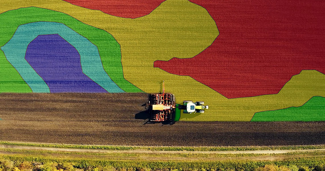
- Management zone maps: Optimised field segments for precise sowing and fertilisation.
- Edge zone smoothing: Maximum utilisation of the entire cultivation area.
- Soil sample analysis: Reliable data basis for sustainable decisions.
Sustainability and efficiency combined
‘With this digital tool, we are providing farmers with an effective means of saving time, money and resources,’ explains Simone Schmiedtbauer, State Councillor for Agriculture. The development underlines the importance of digitalisation and sustainability in Styrian agriculture.
The involvement of the POLICIES Institute emphasises the importance of research for practical solutions. The close cooperation with Maschinenring and the Province of Styria has made it possible to develop a technology that offers not only economic but also ecological benefits.