- About us
- Research fields
- DIGITAL – Institut für Digitale Technologien
- MATERIALS – Institut für Sensorik, Photonik und Fertigungstechnologien
- ROBOTICS – Institut für Robotik und Flexible Produktion
- COREMED – Zentrum für Regenerative Medizin und Präzisionsmedizin
- HEALTH – Institut für Biomedizinische Forschung und Technologien
- LIFE – Institut für Klima, Energiesysteme und Gesellschaft
- POLICIES – Institut für Wirtschafts-, Sozial und Innovationsforschung
- Business areas
- Products & services
- Research infrastructure
- Beteiligungen
- Career
- Aktuelles
- Publications
- Kontakt zu uns


ALaDyn
RUNNING TIME:
01/2025
—
12/2026
Total project duration:
2 Years
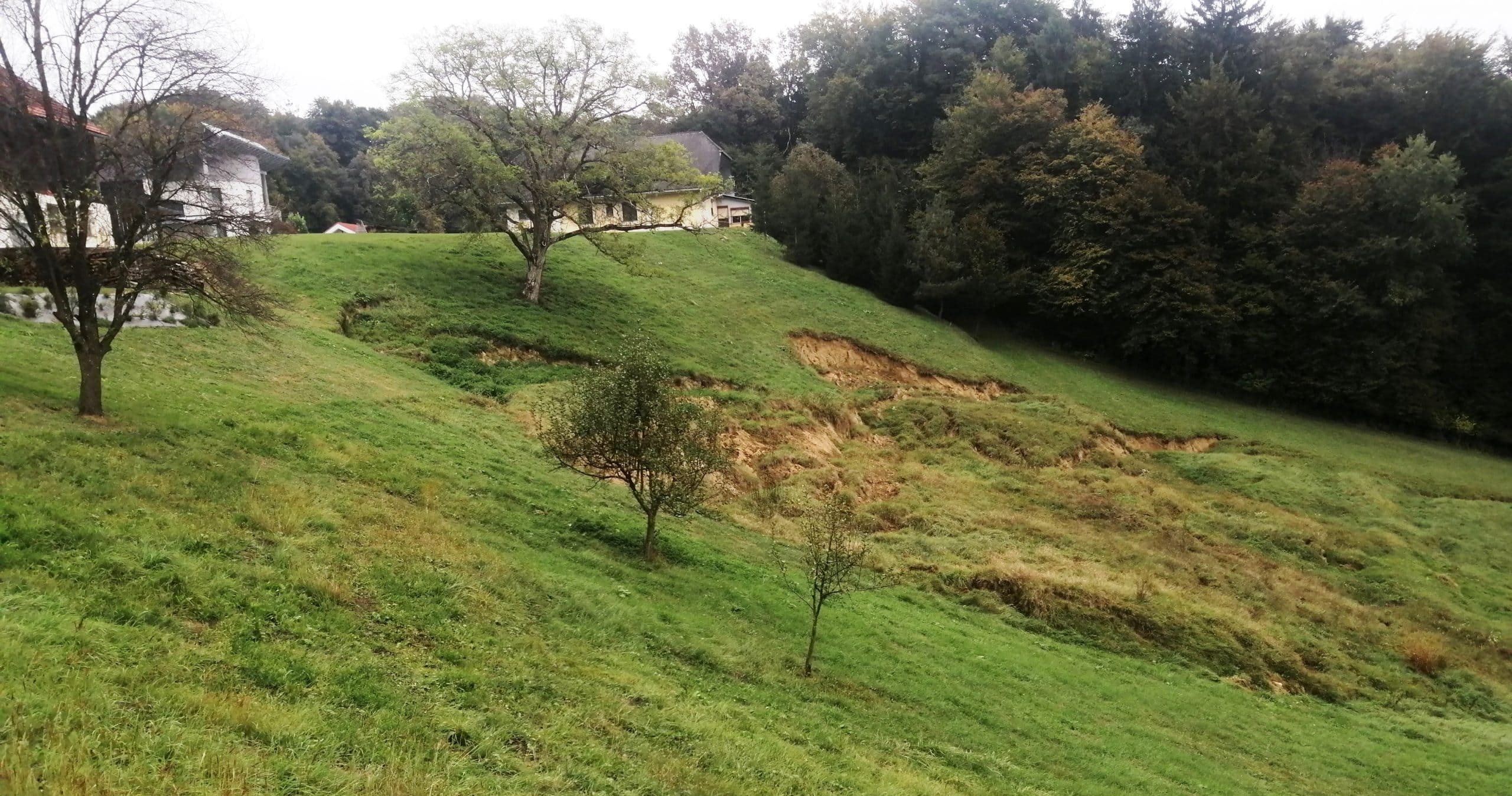
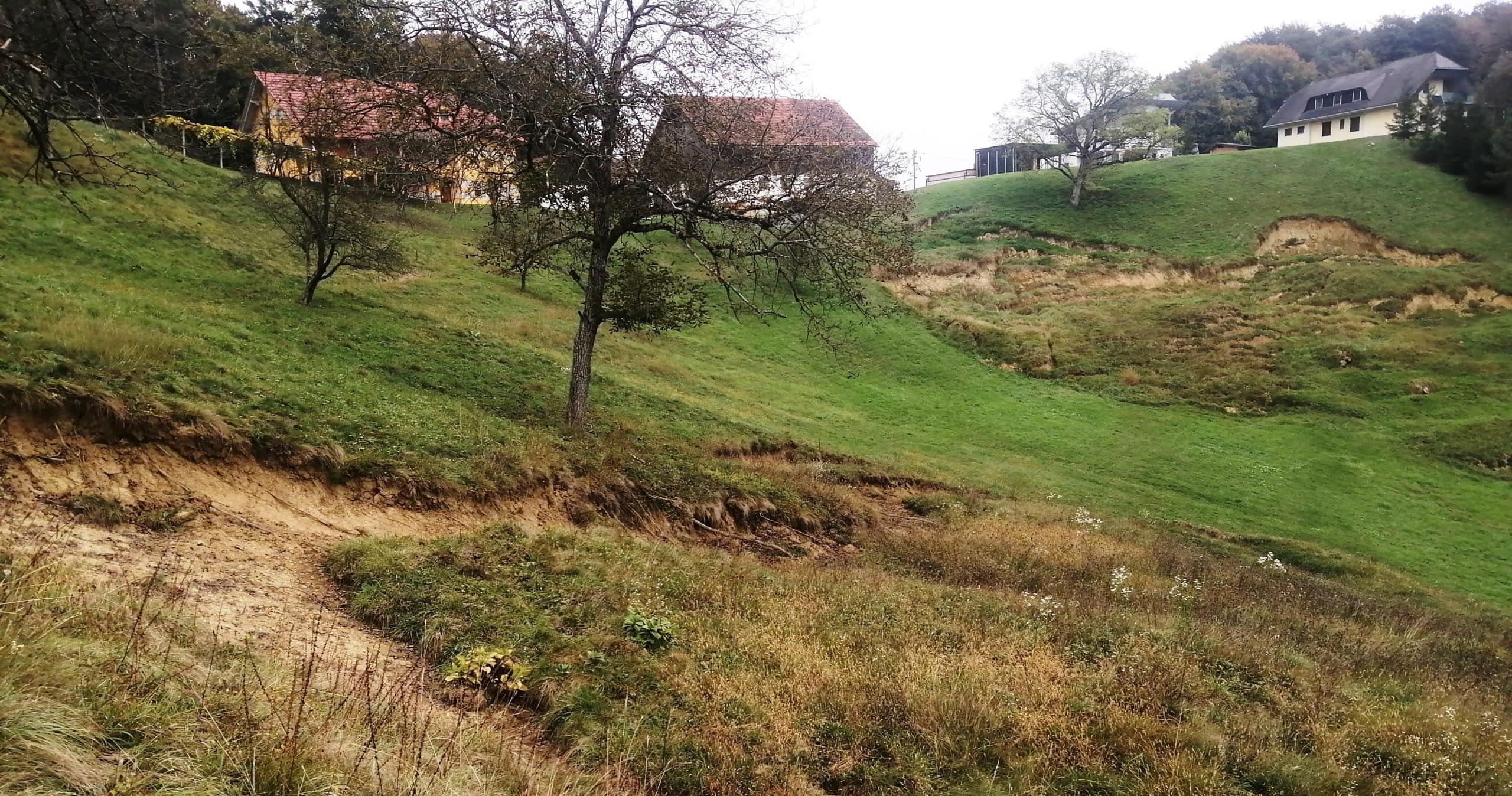
South-eastern Styria, extreme weather event in 2023 Photo: JOANNEUM RESEARCH
The project
The collaborative project ALaDyn (Assessment of Landslide Risk in Dynamic Environments) is dedicated the development of an application previously not considered within the framework of Austria's Digital Twin: modelling gravitational mass movements with special focus on dynamic factors (e.g. weather) influencing such events. Goal of the project is the creation of a demonstrator that specifically exploits synergies with the European flagship initiative DestinE.
Participation in the ECMWF partnership programme enables Austria to contribute its Earth observation and modelling expertise to DestinE. A dynamic landslide susceptibility model is being developed in southern Styria, where precipitation-induced landslides, which occurred during intense rainfall events in 2009 and 2023, are well-documented.
The model combines dynamic weather and land use data, including such from DestinE, with static geomorphological and geological information. The aim is to develop an automated prototype that provides daily updated hazard maps, enabling improved forecasting of heavy rainfall events and associated rainfall-induced landsliding.
Our activities in the project
An interdisciplinary team of research institutions (University of Graz, JOANNEUM RESEARCH) and a regional civil engineering company (Lugitsch & Partner GmbH) is working together on this project to replace static landslide susceptibility models with dynamic ones. JOANNEUM RESEARCH has taken the lead in this project and focuses primarily on data preparation, model development, model deployment and users’ need evaluation.

Research groups
Downloads
Customers
Project partners
Uni Graz – Institut für Geographie und Raumforschung
Lugitsch & Partner Ziviltechniker GmbH
Project details
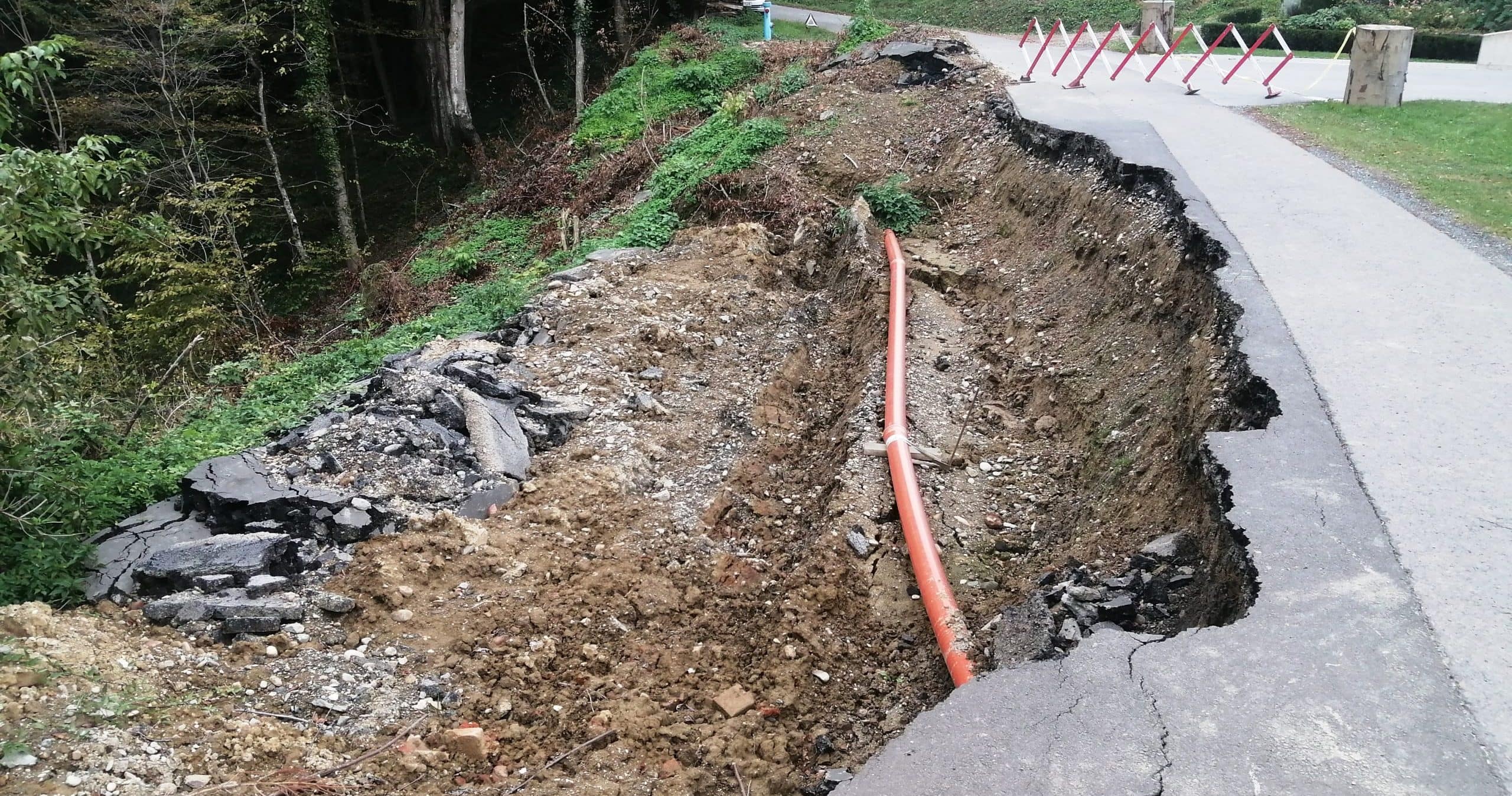
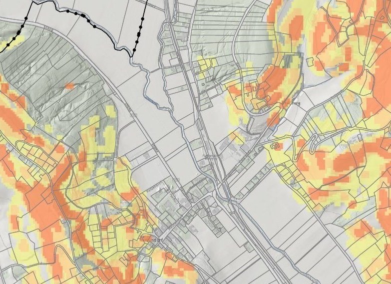
Millions of people worldwide live in areas with high landslide risk, annually causing numerous fatalities and significant economic losses. Rainfall-induced landslides cause the majority of those losses. Particularly Europe is heavily affected, and within Europe, Austria is one of the most vulnerable countries. In Austria slopes are often prone to gravitational mass movements due to the geomorphological and geological conditions. Landslide susceptibility modelling, typically providing landslide hazard maps as end-products, usually focuses on static factors such as geology and morphology. Dynamic influences like extreme weather, deforestation, or land-use changes are often overlooked. However, they are becoming increasingly important due to climate change.
This study addresses this gap by developing a digital twin model for landslide susceptibility that considers both, static conditions like geomorphology and geology as well as dynamic triggers such as rainfall, land-use changes, and land cover changes. The model area is located in southern Styria, where well-documented landslide-inventories have been established in the last two decades. Thousands of landslides were documented during rain-fall triggered landslide events in 2009 and 2023. The August 2023 event, triggered by the low-pressure system “Zacharias,” highlights the significance of more frequent and intense rainfall events. In this single event over 3,000 landslides were documented, and damages in southeastern Styria amounted to more than 30 million Euros.
A major challenge for accurate modelling is the lack of detailed time series data on extreme weather events and their associated landslides. However, extensive data is available in the project region, which can be used for both calibration and validation of the models. Additionally, weather data from ECMWF, developed under the EU/ESA initiative DestinE ("Destination Earth"), as well as weather data from the Wegener Network and INCA (Geosphere Austria), are utilized. Furthermore, land-use data from Copernicus is incorporated into the models, along with data from Austrian databases such as GTIF-AT. Remote sensing technologies like LiDAR are also employed to better capture the protective function of forests.
The goal is to develop an automated prototype that generates daily hazard maps based on various scenarios, such as sudden extreme weather events, land-use changes, or preventive measures. Calibration and validation will be based on the heavy rainfall event, associated with rain-fall triggered landslide events in 2009 and 2023.
Funding organisation

Projektbeteiligte
Related projects
SHAPING THE FUTURE, TOGETHER
JOANNEUM RESEARCH provides innovation and technology services in the field of applied research. As a research company working on behalf of various federal provinces and regions in Austria, our expertise shapes the development of our modern society and economy – sustainably, and always with a focus on people. As a multidisciplinary team working in a flexible set-up that fosters innovation, we always live up to the highest social and scientific standards.