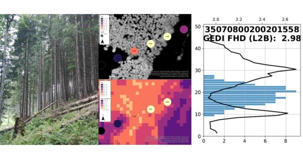
For precise carbon modeling and detailed forest monitoring, homogeneous, large-scale information on various forest parameters such as canopy cover, vertical structure or biomass is essential. Usually, forest structure parameters are derived from airborne laser scanning (ALS). However, the use of ALS data is quite costly in terms of acquisition, processing time and computing capacity and is therefore not practical for large-scale applications.
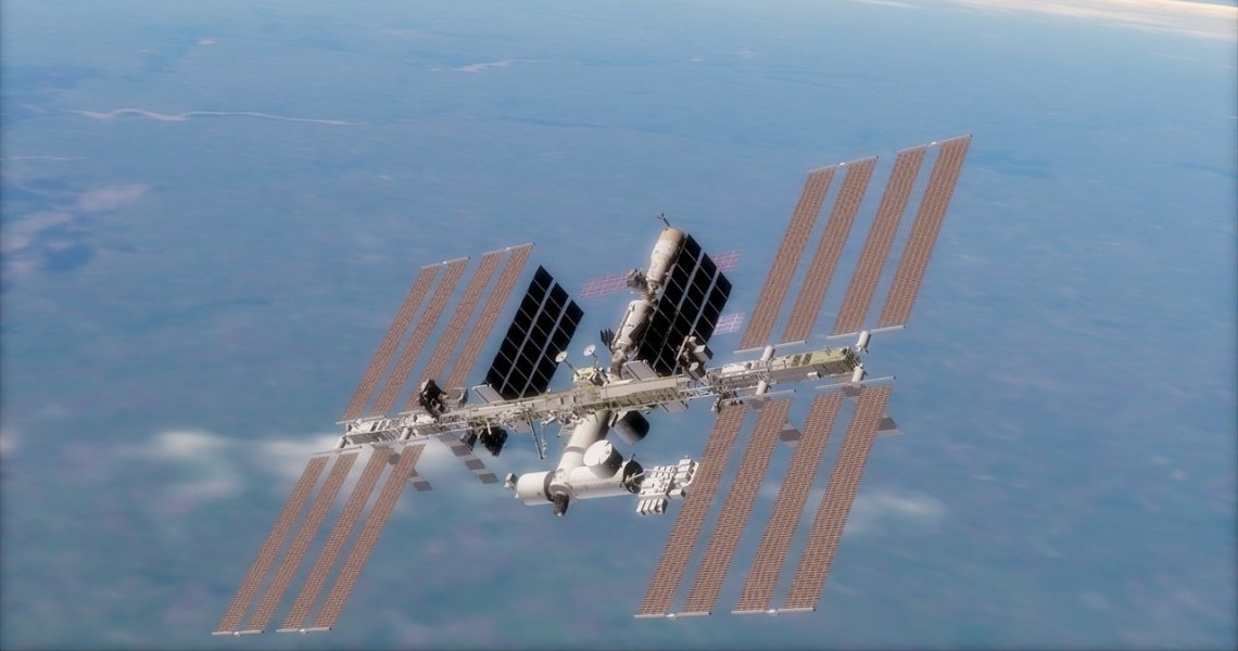
The first data sets from the space-based LiDAR system GEDI (Global Ecosystem Dynamics Investigation) have been available since the end of 2019. The sensor, which is located on the International Space Station (ISS), provides precise, high-resolution backscatter curves of the Earth's 3D structure. GEDI's precise measurements of top height, vertical structure and terrain height will provide valuable information for carbon modeling and forest monitoring, as well as support the derivation and assessment of indicators for monitoring the United Nations Sustainable Development Goals (SDGs).
In the GEDI-Sens project, the suitability of the combination of canopy cover, vertical structure, terrain height and biomass derived from the GEDI data with Copernicus Sentinel-1 and Sentinel-2 data is analyzed to generate area-wide information for various forestry applications in Austrian and tropical forests.
Three different possibilities of synergetic use are being investigated in more detail by our experts. First, the usability of GEDI data for the automatic generation of training data for the classification of forest parameters, as well as deforestation/forest degradation in European and tropical forests. Furthermore, the potential of Sentinel-1 and Sentinel-2 for the improvement of grid-based GEDI products on canopy cover, terrain height, vertical structure and biomass will be determined. Last but not least, the potential for new forest monitoring products based on the fusion of GEDI and Sentinel data will be determined.