Weidendom Experience Centre in Gesäuse National Park Photo: Gesäuse National Park Ltd/Stefan Leitner
For around 20 years, the INTERREG project HabitAlp has been pursuing the goal of collecting information on land use and land cover in Alpine protected areas using remote sensing methods. In the Gesäuse National Park, comprehensive mapping has already been carried out for three years: 1952, 2003 and 2013. Repeating this regularly provides information about the dynamic changes in the landscape caused by natural events such as storms, avalanches, floods or mudslides, but also by the influence of climate change and human use.
The traditional approach to mapping is now being further developed with the help of a process developed by JOANNEUM RESEARCH and the University of Graz: instead of time-consuming visual image interpretation, changes are recorded using state-of-the-art AI methods. In addition to the aerial photographs used to date, high-resolution satellite and laser scan data are being used to precisely map changes in habitat types. The Gesäuse National Park is thus serving as a test region to lay the foundations for fast and cost-efficient monitoring of alpine protected areas.
JOANNEUM RESEARCH is coordinating the project team, which consists of the University of Graz and the Gesäuse National Park administration as users and clients. In addition to project management, the focus is on the development and application of computer-aided methods in the field of artificial intelligence. Thanks to the expertise already acquired in the original HabitAlp project, existing knowledge on the interpretation of habitats in the national park can be specifically applied and further developed.
Universität Graz
Nationalpark Gesäuse (NPG)
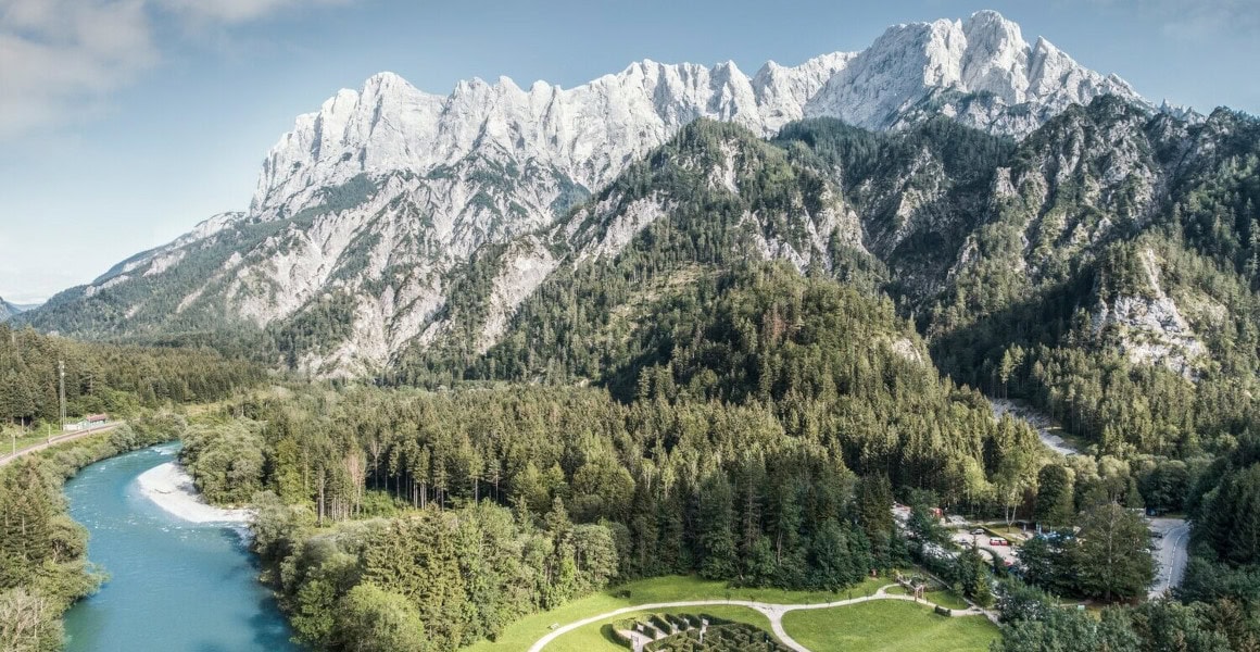
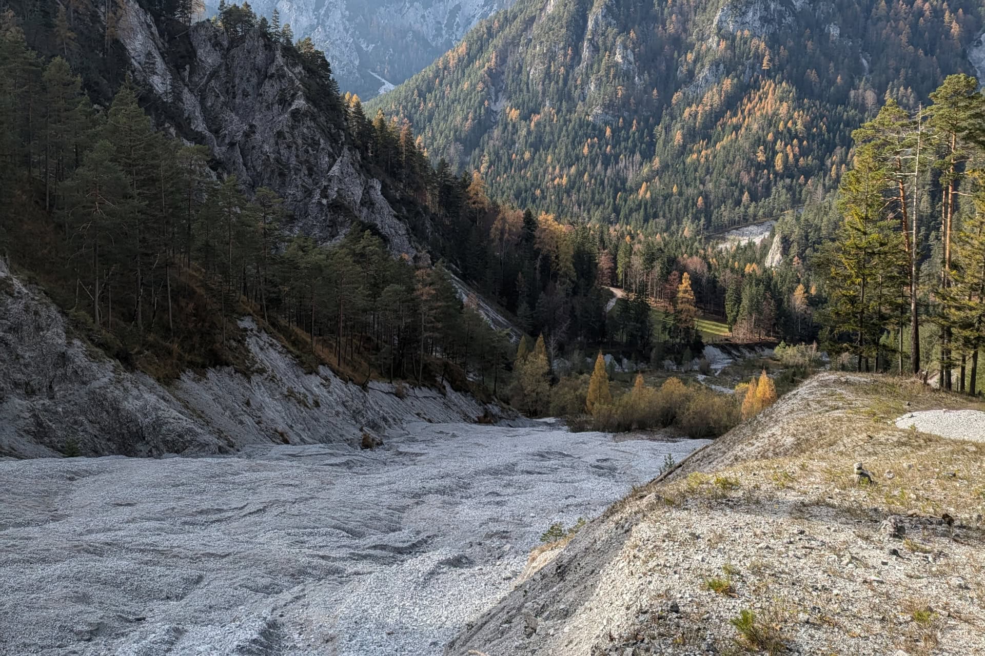
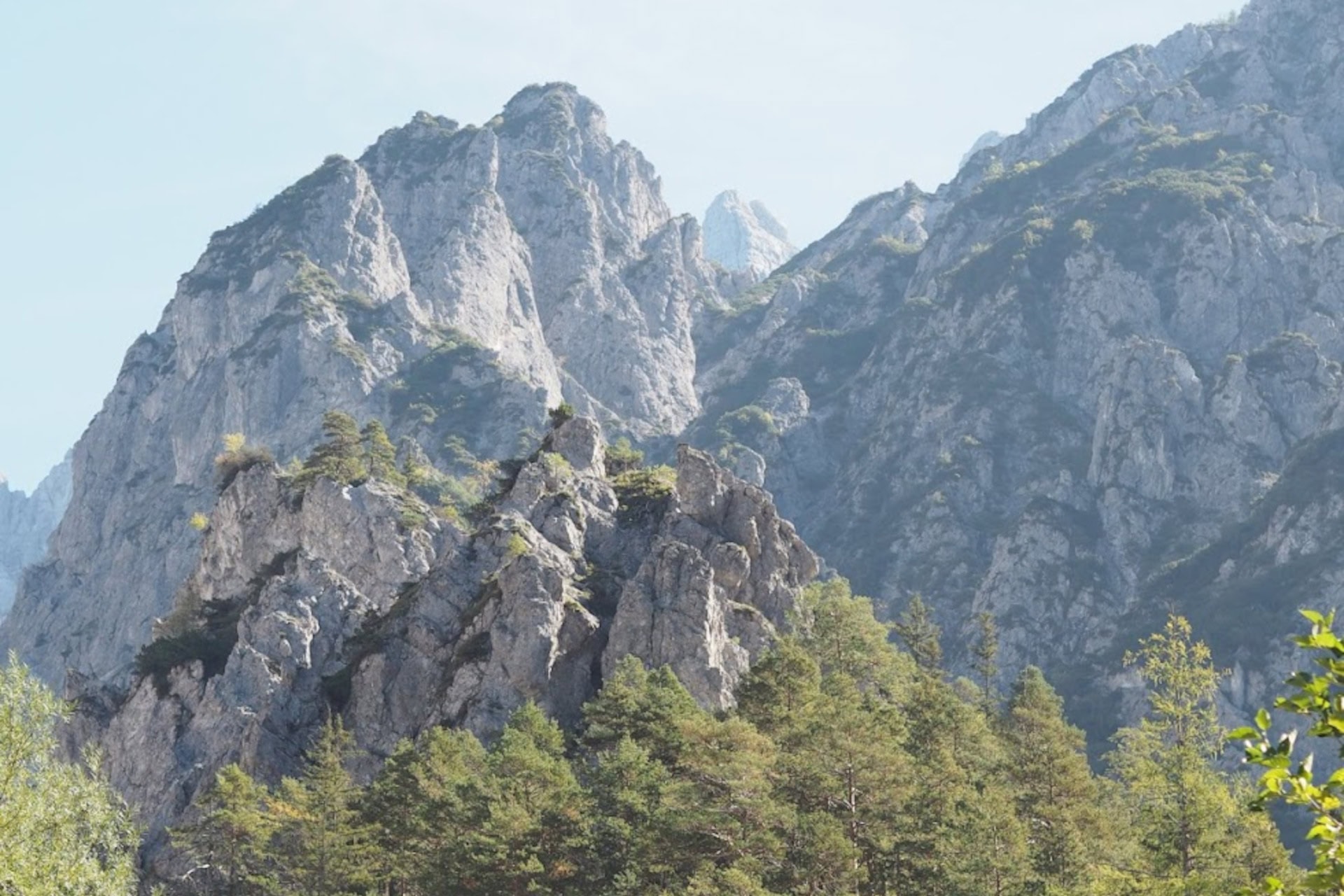
Alpine habitats are subject to constant landscape change processes – due to erosion, vegetation dynamics or natural hazards. The effects of climate change are further accelerating these processes. Regular, precise monitoring is necessary in order to develop effective protection and adaptation strategies.
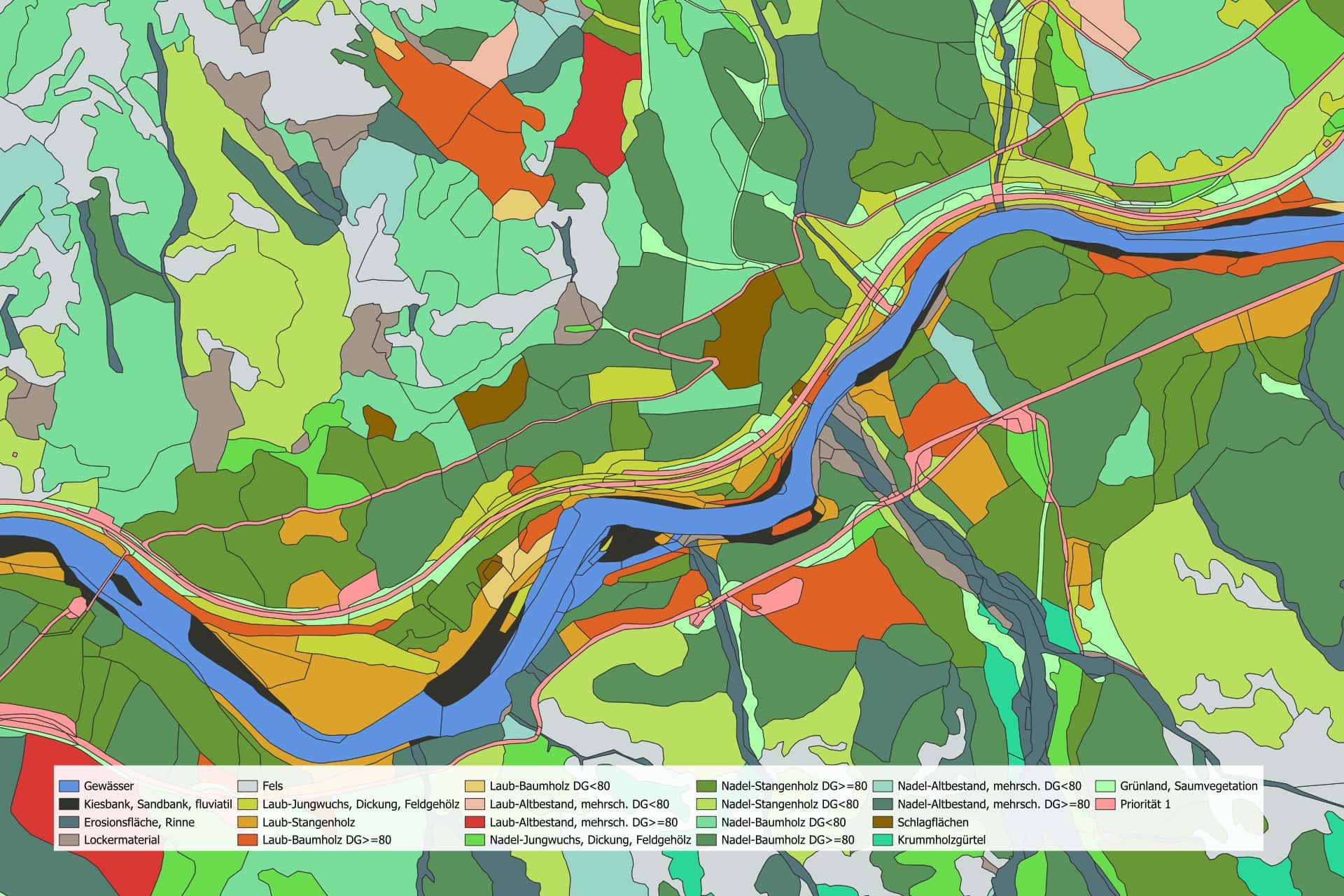
The HabitAlp methodology used to date relied on the manual evaluation of aerial photographs, which were used to create detailed maps of over 100 habitat classes. Although this method provided very high-quality data, it was also particularly time-consuming and costly.
With HabitAlp2.0, we are therefore testing modern, AI-supported methods to enable an automated and significantly faster process for mapping landscape dynamics in protected areas. This is being applied to the entire area of the Gesäuse National Park, where changes between 2013 and 2024 are being mapped.
High-resolution RGB and infrared aerial images, satellite data (Sentinel-2) and airborne LiDAR data (ALS) are used to enable reliable monitoring. The datasets created in the original HabitAlp project serve as a reference for training the models.
Project goals
FFG project number FO999911960
JOANNEUM RESEARCH provides innovation and technology services in the field of applied research. As a research company working on behalf of various federal provinces and regions in Austria, our expertise shapes the development of our modern society and economy – sustainably, and always with a focus on people. As a multidisciplinary team working in a flexible set-up that fosters innovation, we always live up to the highest social and scientific standards.