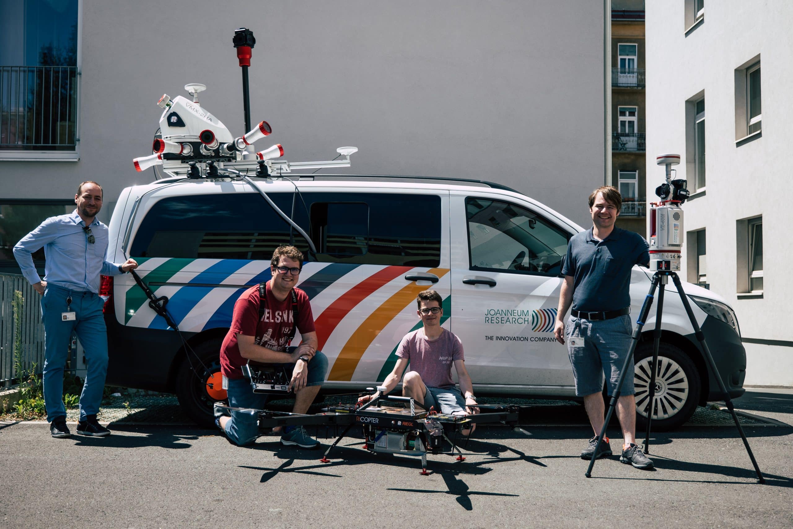
Digital Twin Lab
Our nationally unique research infrastructure is capable of producing spatial digital twins. Vehicle-based, airborne and terrestrial laser scanners are used for high-precision surveying of the environment to generate output data for automated derivation of digital images of reality, 3D models and high-precision reference maps (UHDmaps®).
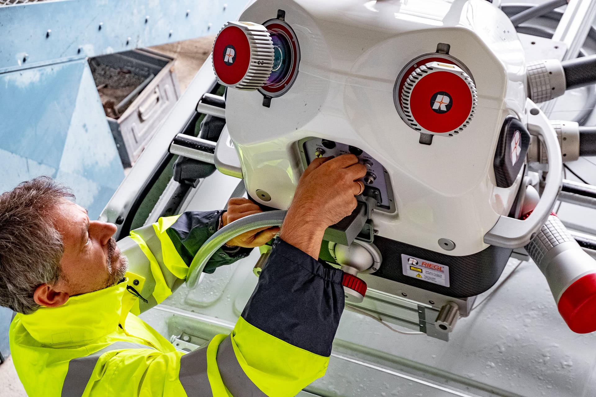
Body on the vehicle
The Riegl VMX-2HA is the latest generation of RIEGL's vehicle-based mobile mapping system. It is used on a measuring vehicle to measure the road surface with millimetre accuracy. Two laser scanners record 3.6 million measurement points per second, 7 cameras and a panoramic camera can record 114 megapixels.
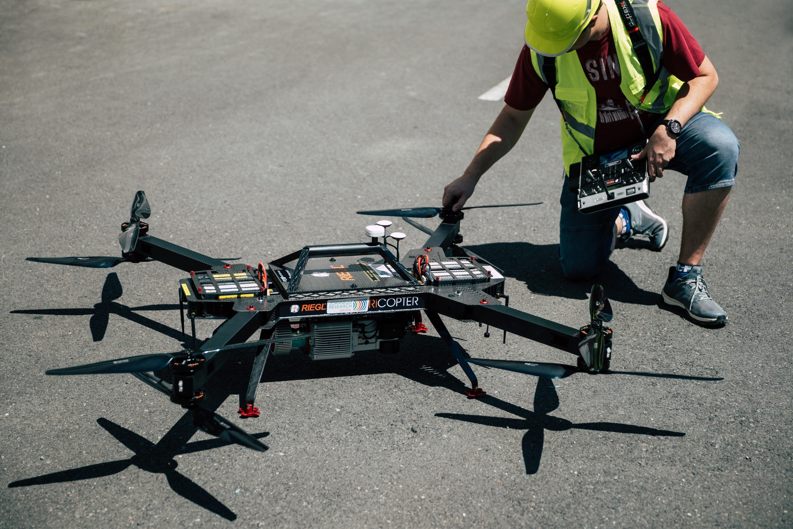
Survey drones
The drone is a fully integrated system for UAV-based surveying tasks. With a weight of 11 kg and a payload capacity of 7 kg, it can carry a laser scanner, an optical camera and a thermal camera, and can cover 2 km² per flight.
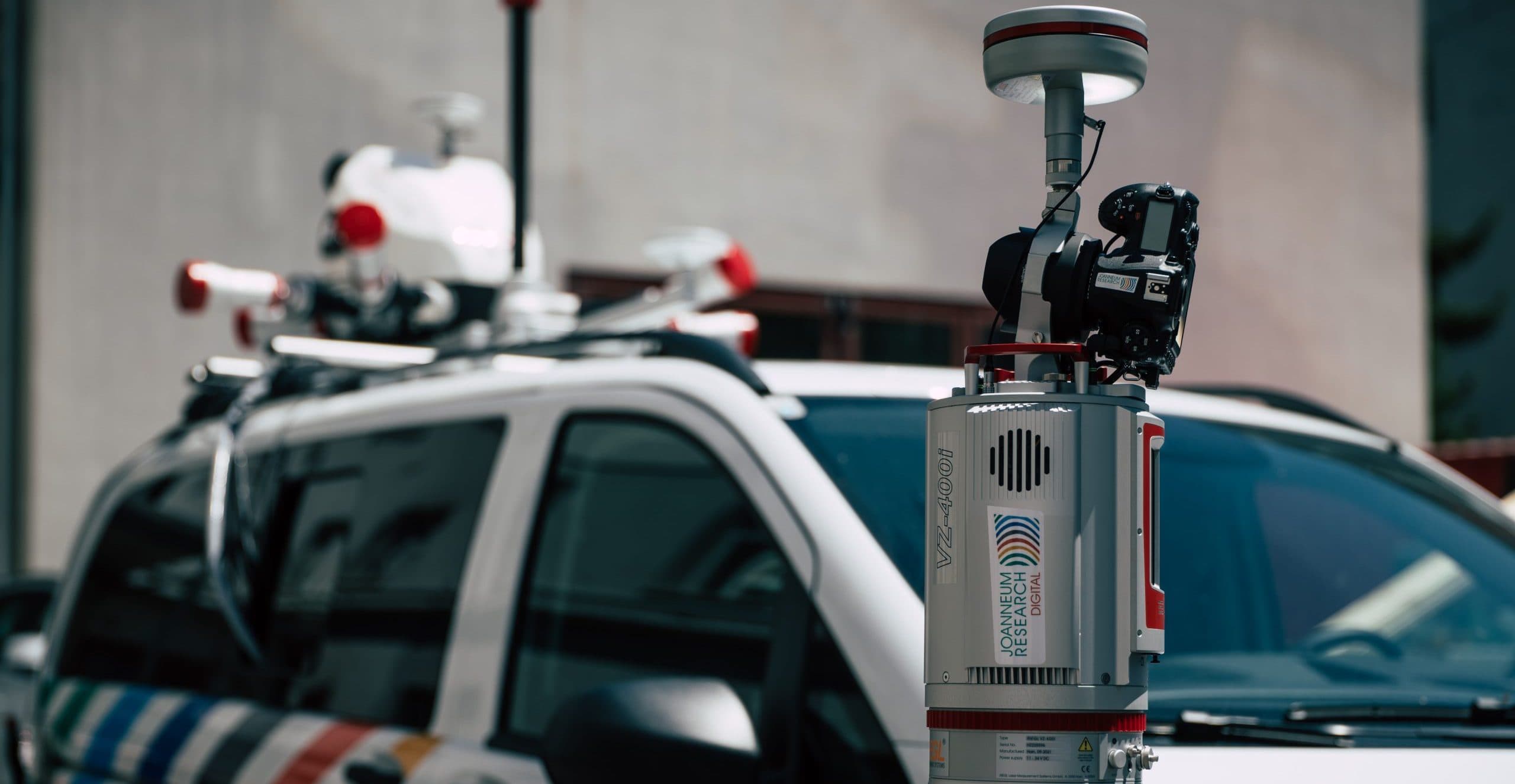
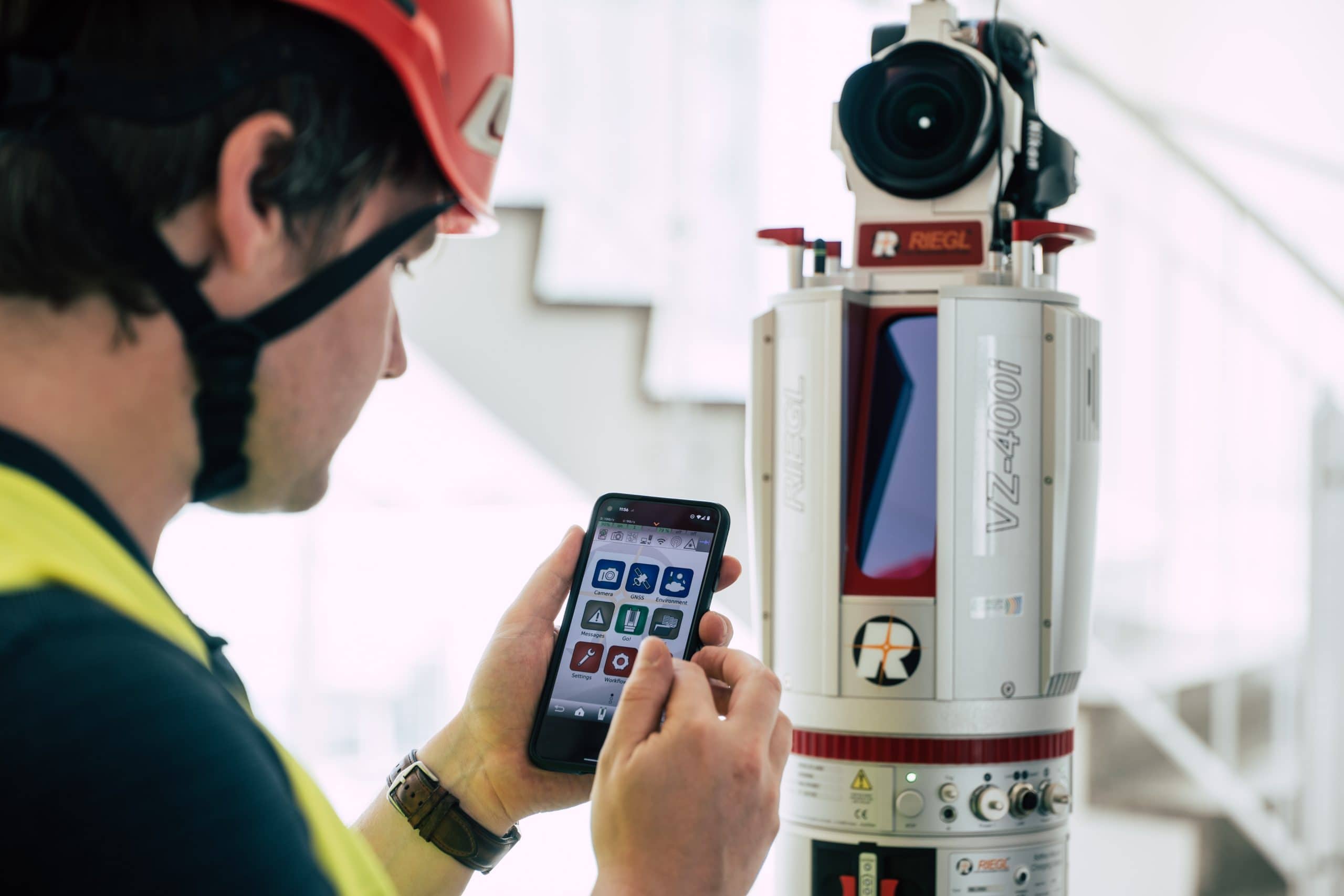
Terrestrial laser scanner laser scanner
Our state-of-the-art 3D laser scanning system combines the simultaneous acquisition of scan and image data with a special processing architecture. The system provides advanced signal processing (waveform processing, multi-target capability), automatic on-board registration and georeferencing using RTK-based positioning.
Mobile laser scanner
The Viametris MS-96 is a modular, mobile laser scanning system for indoor and outdoor surveys that can be used in a backpack or vehicle configuration. It consists of a panoramic camera combined with two LiDARs capable of capturing up to 960,000 points/sec. A GNSS receiver with a high performance IMU enables the implementation of SLAM techniques.