The innovative technologies of the DIGITAL TWIN LAB make a significant contribution to improving road infrastructure and increasing the efficiency of road maintenance. The early detection of road damage such as cracks, ruts or potholes and the targeted planning of maintenance measures not only increase road safety, but also extend their service life. At the same time, resources are saved through optimised maintenance and the sustainable use of infrastructure is promoted.
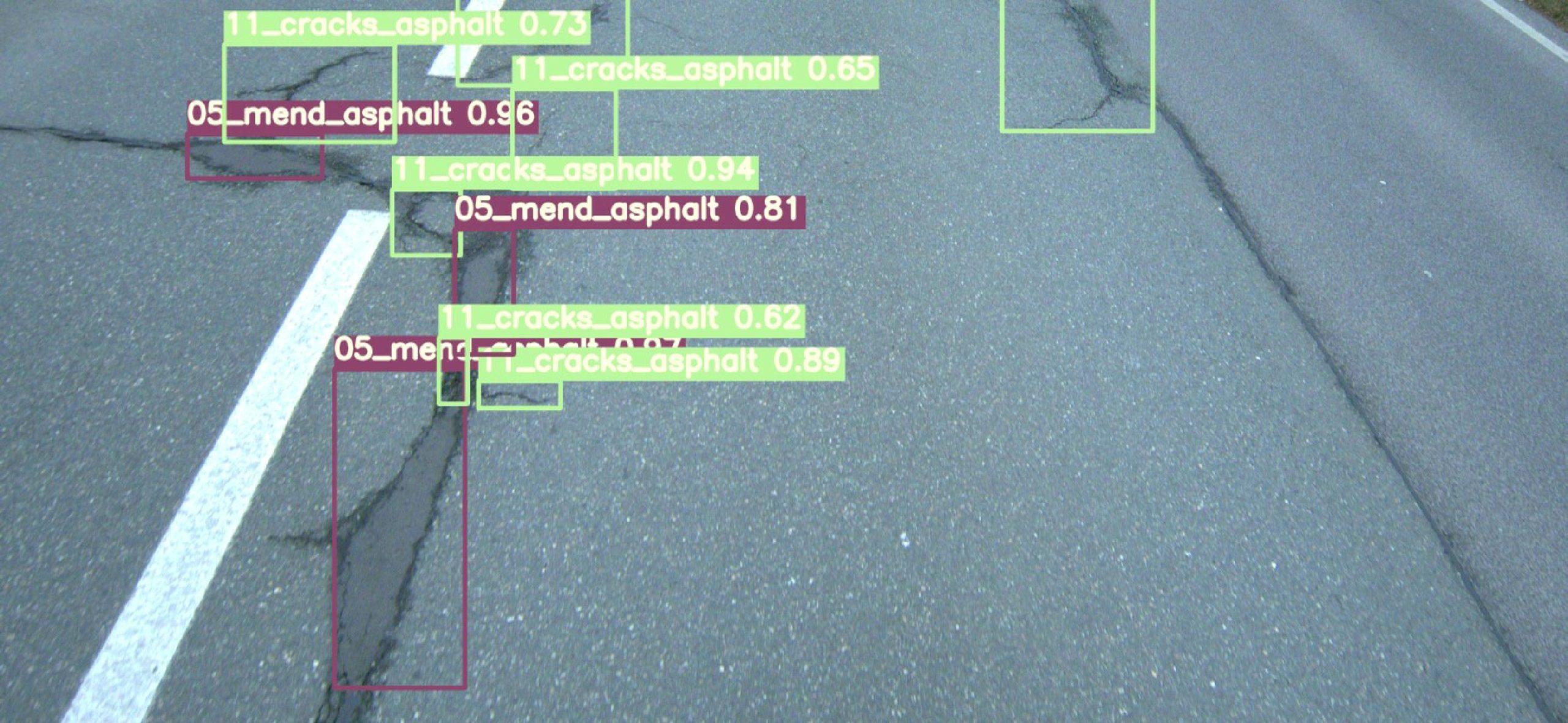
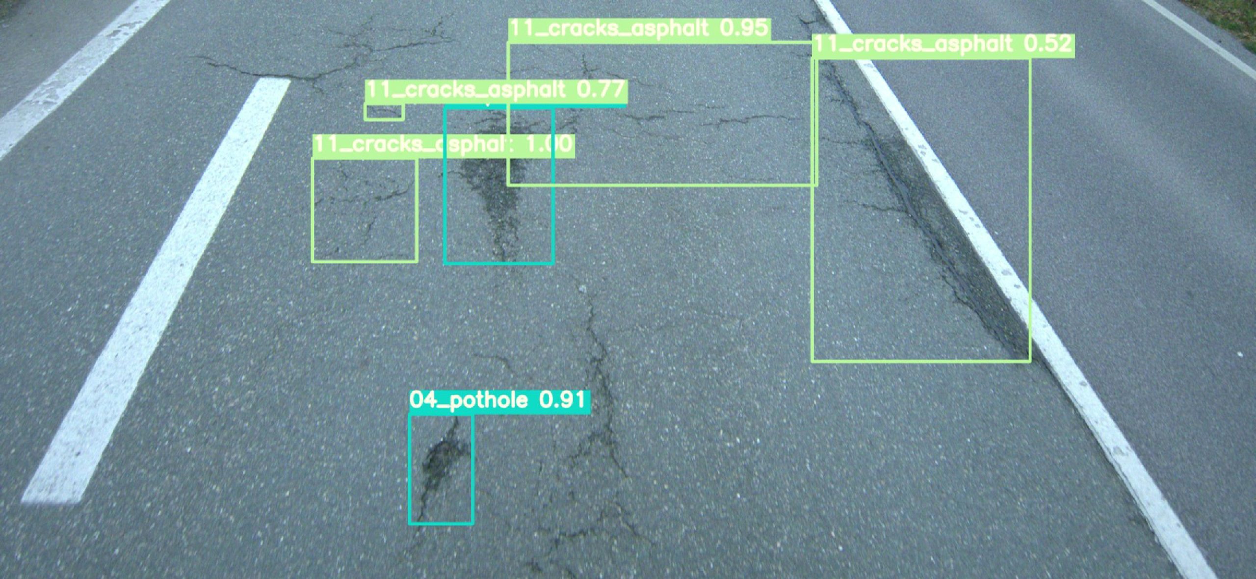
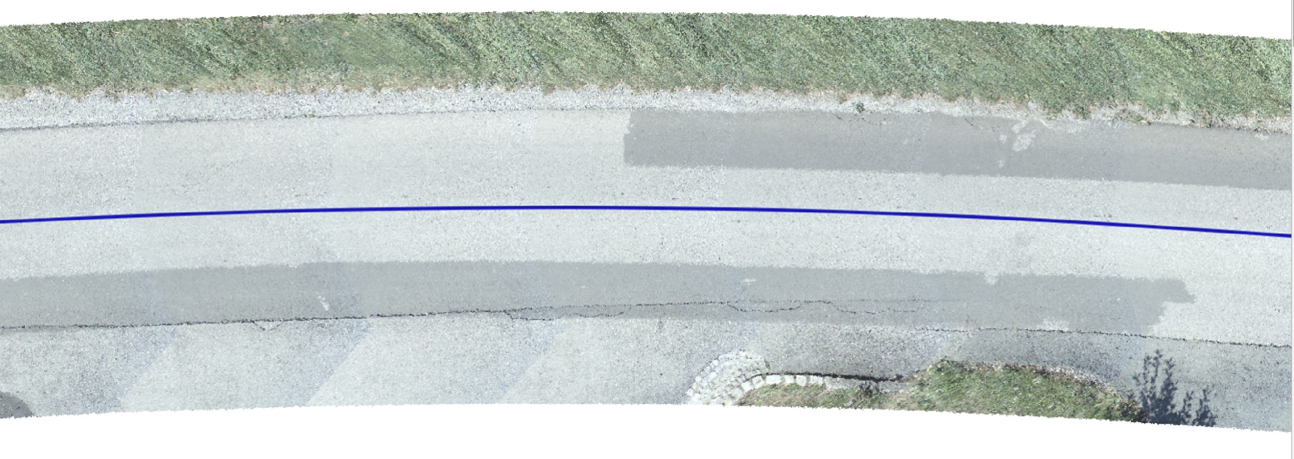
Our experts rely on a specially developed sensor platform, the Roadwear Mapping System. This advanced technology makes it possible to record the surface of roads with extreme precision. The sensor platform generates high-resolution image data, which, in conjunction with exact georeferencing, provides the basis for detecting and classifying road damage. Thanks to this innovative method, even the smallest cracks or unevenness can be recognised. Roadwear-Mapping-System. Mit dieser fortschrittlichen Technologie ist es möglich, die Oberfläche von Straßen äußerst präzise zu erfassen. Die Sensorplattform erzeugt hochauflösende Bilddaten, die in Verbindung mit einer exakten Georeferenzierung die Grundlage für Detektion und Klassifikation von Straßenschäden bereitstellt. Dank dieser innovativen Methode können selbst kleinste Risse oder Unebenheiten erkannt werden.
The data obtained is then used to create a comprehensive road condition map, which enables effective prioritisation of maintenance measures. Through the targeted planning and implementation of repairs and refurbishments, road operators can save costs and thus ensure road safety more effectively. Straßenzustandskarte zu erstellen, welche eine effektive Priorisierung von Instandhaltungsmaßnahmen ermöglicht. Durch die gezielte Planung und Durchführung von Reparaturen und Sanierungen können Straßenbetreiber Kosten einsparen und somit effektiver die Sicherheit auf den Straßen gewährleisten.
We also offer a comprehensive data management platform. This platform serves as a central interface for managing, analysing and evaluating the collected data. It gives road operators easy access to road condition maps and other relevant information and supports them in optimising their maintenance strategies.