Combination of high-precision 3D laser scans with measurement images of the surroundings taken from the air, on the vehicle or on foot.
Through a unique combination of vehicle-based, airborne and people-based mobile mapping systems, the DIGITAL TWIN LAB opens up a new quality of digital twins that enables partners and customers to realise new, innovative business ideas in various areas.
The derivation of exact digital twins of the road is the central area of strength here. Partners and customers use the highly accurate, correct and complete images of reality operationally as a reference for test drives and for the simulation of automated vehicles in validation projects. Thanks to the significantly higher resolution compared to individual systems, universal digital twins of areas can be generated, which can be used for various tasks. The mapping of buildings, covered areas and vegetation with a high level of detail can open up new fields in simulation, spatial planning, asset management, building information modelling and training .
With its mobile mapping services, DIGITAL TWIN LAB offers extensive expertise in the operation of the infrastructure with correspondingly high-quality data acquisition, data analysis and provision of the image. This expertise in sensor calibration and qualification, authorisation procedures and mission planning is also used to offer consulting services and training. Direct utilisation takes place through data acquisition as a service for customers and cooperation partners. In addition to direct orders, data is also collected as part of co-operative research projects. In addition, strategically important areas such as high-ranking road sections and railway networks are recorded in advance and the data is subsequently offered to partners and customers.
Tunnel monitoring that uses artificial intelligence and intelligent microphones to detect critical events in less than 1 second.
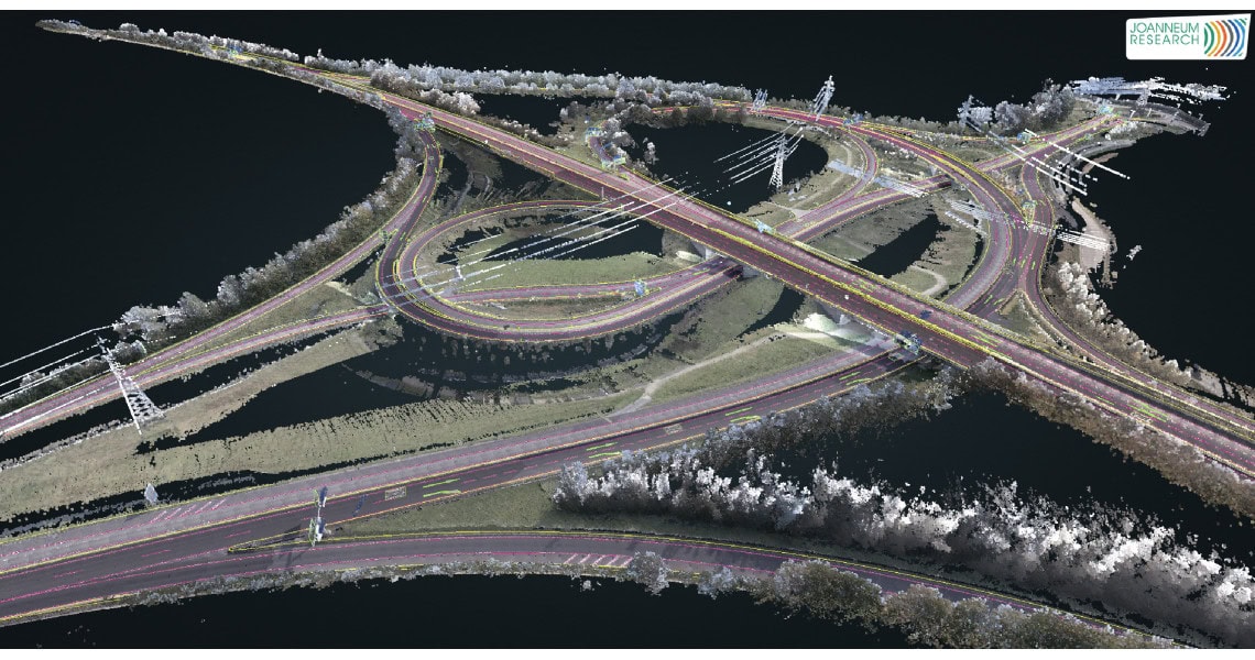
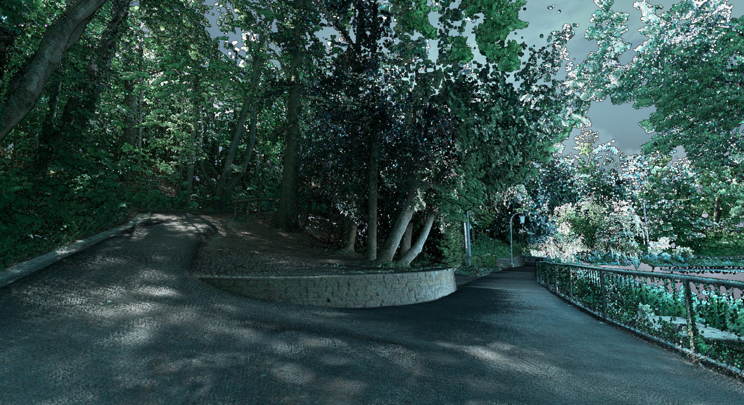
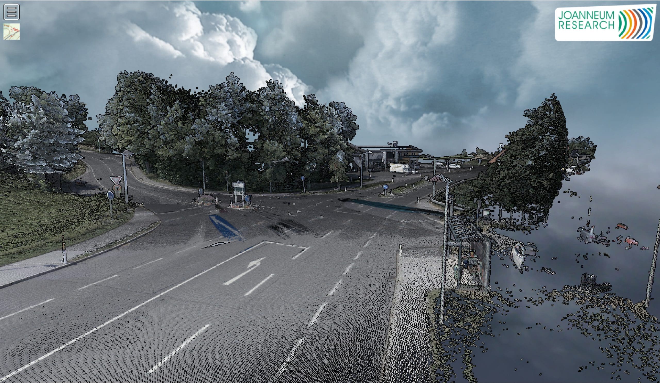
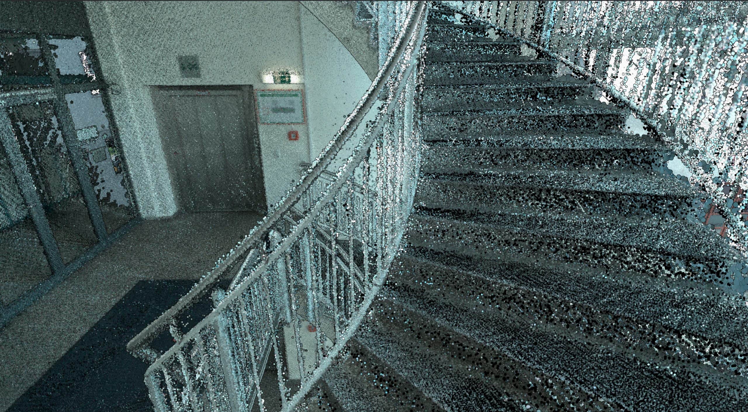
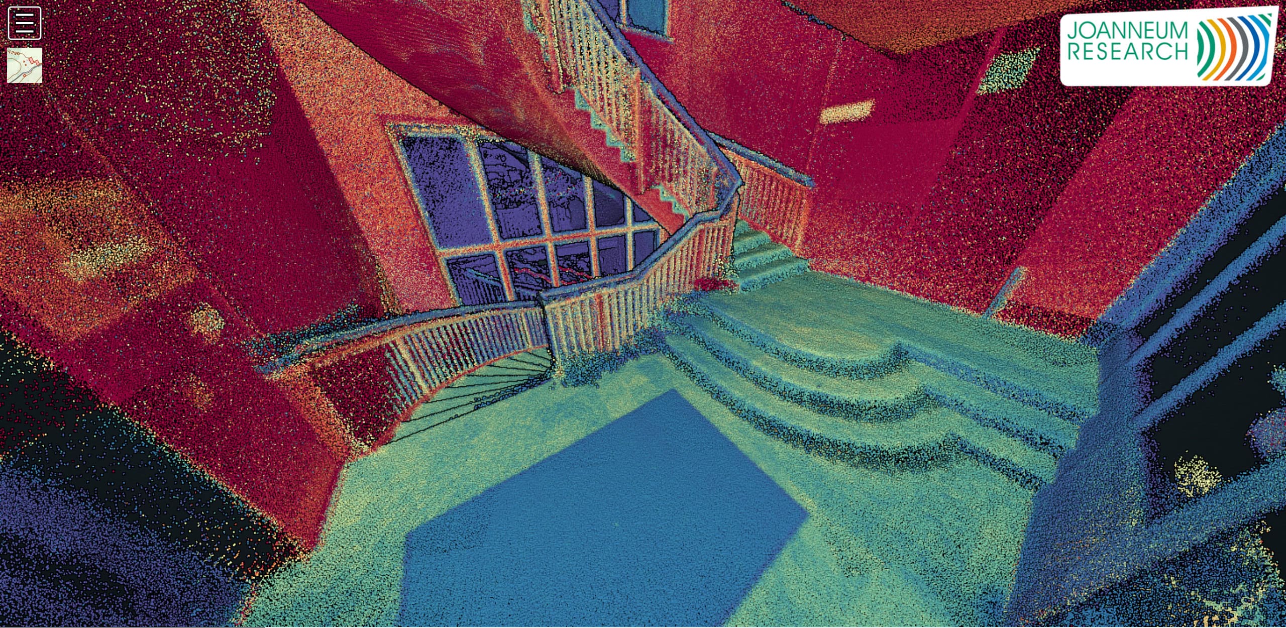
Ultra-hochgenaue Karten und 3D-Umgebungsmodelle für Simulation, Test und Validierung von Fahrfunktionen sowie Sensorik.
With our DIGITAL.culture products, we offer an integrated, constantly evolving, complete solution for modern data management.
Automatic continuous measurement of precipitation particles
Reliable recording of meteorological measurements using camera-based sensor technology and image analysis.
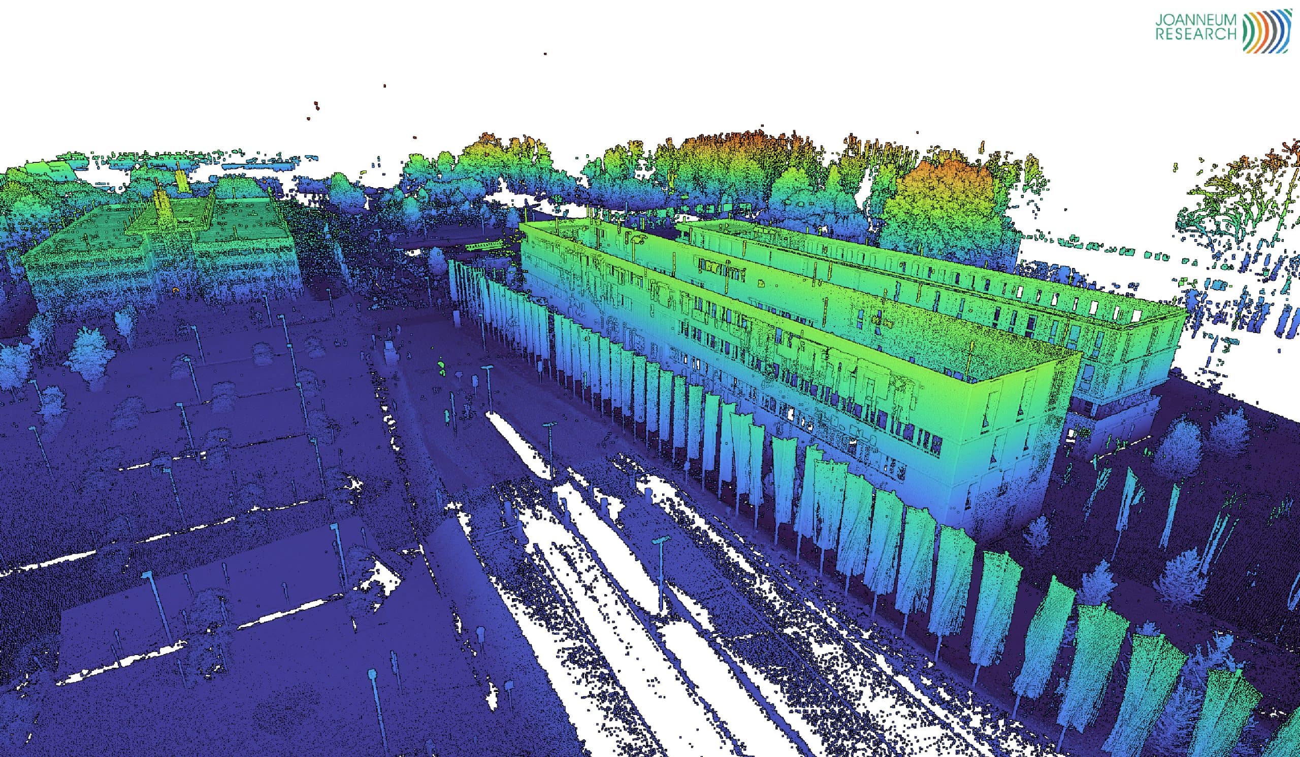
Digital maps for assessing the condition of roads and planning maintenance work.
Automatic tracking and focussing of large satellite reception systems.
JOANNEUM RESEARCH provides innovation and technology services in the field of applied research. As a research company working on behalf of various federal provinces and regions in Austria, our expertise shapes the development of our modern society and economy – sustainably, and always with a focus on people. As a multidisciplinary team working in a flexible set-up that fosters innovation, we always live up to the highest social and scientific standards.