The AlpMon forest monitoring system developed at the Institute of Remote Sensing and Geoinformation comprises two services: A near real-time system for rapid detection and typification of forest changes (storm, logging, etc.) and a forest map service with the latest map material on various forest parameters (tree species, forest type, canopy cover). Both services can be accessed very easily via the Internet using a web browser and all maps can be downloaded digitally and used in a local GIS.
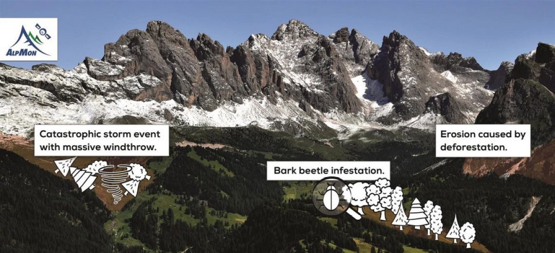
Service 1 maps and quantifies forest damage areas and felling using time series analyses in near real time (~0-14 days). A distinction is made between storm damage, clear-cutting and insect damage. Additional information is provided and statistics calculated for the affected areas (e.g. area information, date of change, political district, etc.). If current 3D data is available, e.g. an ALS model from a LiDAR flight, the timber volume can also be automatically estimated for the affected areas. This is particularly relevant for the survey of damaged timber volumes after storms or due to beetle infestation.
Service 2 offers a selection of the latest digital maps on various forest parameters such as canopy cover, forest type or tree species distribution and on historical forest changes. In addition to our newly calculated maps, helpful "open data" products, e.g. the Copernicus High Resolution Layer, are also integrated.
The easy-to-use and intensively tested user interface enables all maps and satellite images to be quickly retrieved from the Internet and used in your own GIS if required. Further functionalities, such as an alert service by email in the event of major damage events, simple statistics queries and a graphical display of statistics complete the AlpMon offering.