Infrastructure
Portable remote-sensing platform
Infrastructure for multi-sensor data recordings and optional real-time data downlinks.
The associated hardware and software solutions enable multi-sensor data recording, powerful and rapid data processing and, therefore, effective support for time critical decision-making in both the fields of disaster management and environmental analysis.
The management solution allows the coordination of data acquisition, control of processing applications, data archiving, and the corresponding distribution of data to other existing systems.
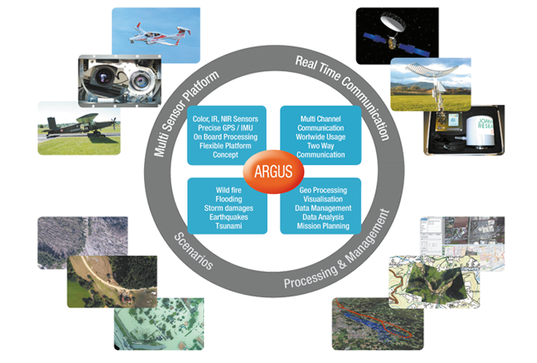
Components of the system
- Adaptable loading platform that can be attached to different aircrafts (Pilatus Porter PC 6, DA 42 MPP, Cessna) (certification available)
- On the platform, sensors for optical, near and thermal infrared imaging and laser scanners are available
- Recording and flight planning as well as control applications for the implementation of admission flights
- Real-time data downlink based on a visual radio software solution (LOS) with a range up to 70 km
- Modules for geometric data processing (near real-time direct georeferencing; precise post-processing solutions; mosaicing)
- Software for geometric and thematic analysis of multi-sensor data
- Analysis and evaluation software
- Geodata management (visualization, data management, archiving, interface services)
- Mobile solutions for applications in the field